
 Haoru UWB
Solution
Summary
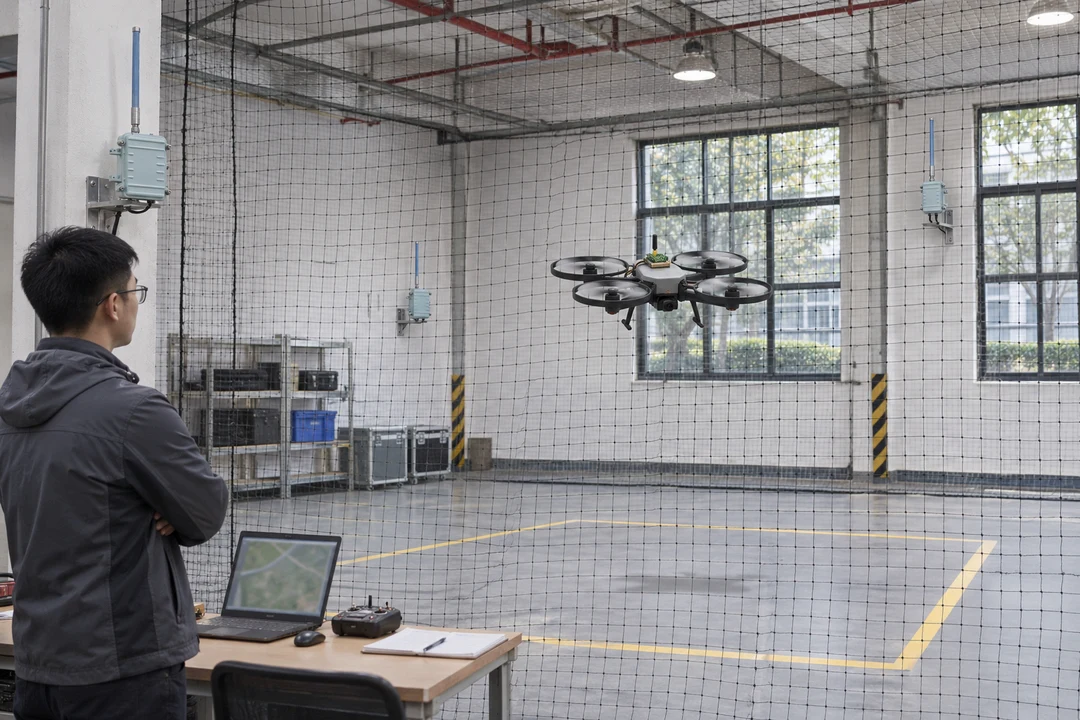
Haoru Technology provides ultra-wideband (UWB) assisted positioning and trajectory recording for drones operating without satellite positioning in indoor test spaces, factories and warehouses. A three dimensional reference is established within a defined flight area. Timed tag coordinates enter the customer's flight controller or test platform and are combined with onboard inertial and height data to support position checks, repeatable testing and flight analysis.
Application Background
During indoor flight control, inspection maneuver or payload tests, drone developers need to establish where the aircraft traveled, whether a hover point drifted and how trajectories compare between trials. Indoor satellite positioning is unreliable, while inertial information alone cannot maintain the same site coordinate reference indefinitely.
The customer already has an aircraft, flight controller and test recording platform. It needs an independent spatial measurement channel to collect comparable position data and reduce recovery and repeated trajectory tests, while retaining existing flight control and protective measures.
Project Challenges
1. The vertical arrangement of base stations affects three dimensional position calculation. A coplanar installation cannot be assessed using the same assumptions as horizontal positioning.
2. Aircraft attitude changes during flight. The frame, propulsion components and payload can obstruct the tag, so mounting must account for weight, antenna orientation and visibility.
3. External coordinates and flight controller coordinates have different origins, orientations and timing. Data must be transformed and checked before entering the customer's fusion program.
Haoru Technology Solution
Haoru Technology positions UWB base stations at different heights around the defined flight area, calibrates their spatial coordinates and installs a tag on the aircraft. Deployment checks cover takeoff and landing points, main flight heights and peripheral segments. Node locations are adjusted from site trajectories rather than transferring a ground based two dimensional layout directly to flight.
We supply UWB ranging, three dimensional position calculation, trajectory recording and data interfaces. The customer's flight controller interface transforms external coordinates into the site's flight frame, compensates for the tag's offset from the aircraft reference point and aligns observations using timing information.
The existing flight controller retains flight control responsibility and fuses UWB positions with inertial, height or other onboard data. Interruptions and inconsistent observations are handled through the customer's protective logic. The test platform stores flight tasks, positions and exception records together so that staff can examine hovering, turns, takeoff and landing.
How It Works
1. Establish the spatial reference: calibrate base stations at different heights and align the coordinate frame with the customer's flight area.
2. Acquire aircraft positions: the tag performs UWB two-way ranging with base stations. Multiple distance observations produce spatial positions with timing information.
3. Fuse with flight data: the customer program transforms coordinates, aligns timestamps and checks validity before combining observations with onboard sensors.
4. Record and review: save trajectories by flight task, compare repeated segments and hover points, and investigate missing data and recovery events.
Solution Advantages
1. A reusable position reference supports comparisons between tests in a defined space without satellite positioning.
2. External measurement and flight control have clear roles, allowing the customer to retain its controller, onboard sensors and protective logic.
3. Linked position, task and exception records reduce reliance on visual observations and separate logs when explaining flight behavior.
Final Results
Repeat flights caused by incomplete position records decreased by 40%. Linking flight tasks with site coordinates reduces repetitions needed to compare missing trajectory segments.
Manual position recovery interventions decreased by 50%. The external reference helps the customer flight controller and test staff establish aircraft position.
Time spent consolidating test position data decreased by 60%. Common task identifiers and timing records reduce manual matching of flight logs and trajectory files.